Sunday, December 28, 2014

The Fortress - September 15, 2013

The Fortress
Trip Date: September 15, 2103
Classification: Scramble
Difficulty Level: Easy
Elevation Gain/Summit Elevation: 1100m (3,608 ft)/3000m (9,843 ft)
Distance: 17.2km (round trip)
Location: 50.82N, 115.23W
______________________________________________________________________

The Fortress is located in the Central Kananaskis Range in the picturesque Chester Lake area.  It is one of three mountains that can be access from the Chester Lake trail head and combines a picturesque hike and a beautiful alpine lake with an easy scramble (an optional moderate down scramble can easily be added).

You are likely to share the first part of the trail to Chester Lake with other hikers, but once past the lake the valley will likely become yours alone, and the views just get better and better.

The summit provides views of hundreds of mountains including Mt. Assiniboine, Mt. Joffre and Mt. Sir Douglas.  The large summit can also allow for a quick summit nap without any risks of fall.

Chester Lake Trail in September.  Gusty Peak (Centre), Mt. Chester (Right),
the Fortress (behind Gusty Peak).  Click to enlarge

Click here to read the trip report.

Sunday, September 30, 2012

Sulphur Mountain - A Banff Gem

Overlooking Banff, Sulphur Mountain is often overlooked as a scrambling destination mainly due to the fact that you can take a gondola to the Observatory 700m above the townsite.  Up until a few days before this outing, I thought that Sanson Peak was actually the summit and the hike included a boardwalk and stairs. 

As I found out, this is not the case, in fact Sulphur Mountain is a 4km long mountain ridge and Sanson Peak is only one of 4 Peaks.  The true summit lies about 2.5km southwest of the Observatory and the trail provides some safe and fun scrambling along with a faily easy hike that I think can be done year long.


Find out more about the adventure by clicking here...


Saturday, January 21, 2012

Ha Ling - A Windy Affair


This is likely my last post about Ha Ling as you can only write so much about a trip that is esentially a difficult hike and I have covered both winter and summer ascents.

The nice thing about Ha Ling is that when many other peaks are out of season, socked in by weather or in just plain dangerous conditions, this peak is almost always summitable. In other words, this is considered an all-year summit. Located directly behind Canmore to the west, this summit is a good half-day trip and one of the best places to test people's endurance and hiking skills. We decided to do Ha Ling after we checked out the weather forecast that morning and saw that we were in for snow and high winds.

Trips up Ha Ling (which is mainly a hiking trail) are hardly eventful usually the hardest part is finding your way though the throngs of people in the summer. Winter however has a tendency to throw wrenches into what are otherwise uneventful ascents.

Find out more about this adventure by clicking here...

Friday, July 15, 2011

Ha Ling - A Canmore Classic

July is always a good month to revist an old favourite of mine and a favourite of many Calgarians.  Ha Ling rises over 900m above Canmore Alberta, but despite its imposing cliffs, it is a very popular peak that can see over 100 people summit on a warm day.

Nearly 4 months after my last mountain adventure, I decided to take a break from paddling and test out my mountain legs.  Along with four friends we started our way to Canmore to tackle this imposing wall of rock...

The adventure continues by clicking here...

Wednesday, May 11, 2011

Rain, Rapids and Tonnes of Snow - A Bow River Experience

So I just completed a short jaunt on the Upper Bow River from Ghost Dam to Cochrane as part of my South Dakota Kayak Challenge training.  Its a simple stretch of river the consists of a small class II rapid, a little step but some gorgeous turquoise water, and this time, over  feet of snow...

Saturday, March 26, 2011

2011 South Dakota Kayak Challenge And Reflections From 2010

This weekend will mark the 2 month countdown to the Second Annual South Dakota Kayak Challenge. A challenge primarily and a race secondary, that will see about 100 racers line the shore of Riverside Park in Yankton SD and with the sound of a gun, start their journey along a 75 mile (120km) section of the mighty and historic Missouri River, crossing into three states and finally finishing in Sioux City Iowa. As such, I have dedicated this entry to the challenge in an attempt to answer many questions for people that I have talked to that are interested in taking part in this great event.

THE COURSE
As stated, the course is approximately 75 miles (121km) in length, for which each boat will have 30 hours from the starting gun to finish. This 30 hours includes all breaks, naps and calls-of-natures there may be.


The course has 4 check points, Myron Grove, Mulberry Bend, Bolton and Rosenbaum which can divide the race into 5 spearate legs. Below are descriptions of the race based on my experiences last year and from talking ot the organizers and other fellow competitors.

LEG 1
The first leg between Riverside Park and Myron grove is a 17.5 mile (28km) downstream stretch of river that is channeled by numerous large islands and many more smaller islands, however, the flow is relatively unimpeded and the water deep. Last year there were a few sandbars along this route, but nothing major. The only real concern that I would say there is in this leg is a branch in the river after about 5 miles (8km), a smaller branch will flow north while a second brach flows south. I advise all would be paddlers to take the southern branch as its the more direct route and the northern route will lead you through what appeared to be a narrow, shallow channel that has its fair share of small islands you'd have to negotiate around before rejoining the main channel - it also adds about 0.6mi (1km) to your overall distance. I didn't hear about anyone taking the northern route last year - probably because you can still follow the crowd of paddlers, but it wouldn't be hard for a person to take it.

LEG 2
The second leg of the race between Myron Grove and Mulberry Bend is 11.5 miles (18.5km) in length. About 0.5mi (0.8km) after the Myron Grove checkpoint, the river becomes divided by Goat island, an island about 4.5 miles (7.2km) long, forcing you to choose one of two channels - a northern channel and a southern channel. Last year we we pulled into Myron Grove in a group of about 5 boats all within 7-10 minutes of each other. Of those boats, Tyler and I were the only boat to take the south channel. In retrospect, I would still recommend paddlers to take the southern channel. From accounts from volunteers and other racers, the northern channel is more channelized as it is divided even further by smaller islands. When the two channels merged, we had actually made time and distance on a few boats that left Myron Grove before us and even passed one or two. About 0.8miles (1.3km) the Missouri River will start to have fun with you - the river flows around two islands creating 3 channels and water levels drop. Last year the southern channel had many downed trees and some sandbars that were visible. We opted for the middle channel which for the most part was decent, however we pulled too close to the first island and quickly found ourselves bottoming out - coming to a complete stop in the middle of the Missouri River. As we quickly found out, the middle channel has a large barely submerged sandbar that sticks out about a quarter of a mile from the north shore of the island. In retrospect, we should have hugged closer to the southern shore of the second island as I believe the water was deeper. After these islands the river takes a sharp turn to the south where these sandbars are pretty much part of the scenery for the last 5 miles (8km) before Mulberry Bend. It is also around this time the headwind wind really started to pick up (20-30mph, 30-50kph).

LEG 3
The third leg of the race is about 12 miles (19km) from Mulberry Bend to the Bolton checkpoint. I stongly remember a strong channelized current along this section, one that is not hard to miss and if you can ride it, can propel you through the bend in quite a short amount of time - I do also remember som very large boils that threaten to derail your run if you happen to slip out of this current. Just over 3 miles (5km) after Mulberry Bend, the river will fork into three channels. I remember the south channel being filled with shallows and sandbars, the same with the middle channel, however, if you stay river left in the middle channel you should miss the shallows and the sandbars. From the sounds of it, the northern channel is completely clear of sandbars and might be worth attempting this route as the length difference is less than 0.2mi (0.3km) and might mitigate the decrease in speed caused by the sandbars and shallows. Immediately after the shallows two large sandbars are present and highly viible in the middle of the river - avoid them - though if you need a break, I did see one boat pulling over on them. The river channel will then squeeze past a peninsula before flowing around a small treed island - I'd again recommend river right around this island until the Bolton checkpoint.

LEG 4
Bolton checkpoint to Rosebaum comprises the fourth leg of the race. This 14.5 mile (23.3km) section sees the river gradually taper into a more narrow even banked single channel river. About 1.5 miles (2.5km) after the Bolton checkpoint wingdykes begin to appear on the right bank. These are worth crossing the river for. Wingdykes are fabulous inventions, built by the US Army Corps of Engineers, they are rock structed that are built out into the river perpendicular to flow and they force water away from the shore, narrowing the river and creating quick channelized currents as water flows around them. Be warned, they also produce extremely large boils behind the structure, but behind them the water is calm and is a good place to rest if you need to. Be careful about not hitting one though as the force of the watter hitting it can pin and/or capsize a boat - this is more important at night or in low visibilty conditions, normally they are easy to avoid. I have heard stories of this happening (not in the SDKC though). If you are a confident paddler these currents can really be beneficial. The first set of wingdykes will last for about 0.8 miles (1.3km) - enough to let you know if you want to use them. By staying river right you will avoide major channelization and shallower water on the opposite bank as the river turns southwards towards Rosenbaum. The rest of the leg except for the 2.3 miles (3.8km) before Rosenbaum is fairly straight forward paddling with no obstacles. Near the end of this leg wingdykes will again appear, this time on the left shore before stopping and picking up on the right shore. Good paddlers in good conditions iwll be able to skirt across the river and use these to their benefit, at the same time, this is were recreational motor boat traffic will wreak havoc the most - and it will only get worse.

LEG 5
Once you hit Rosenbaum you are 16 miles (25.7km) from the finish line in Sioux City and in the last leg of the race. Technically speaking, this is probably the easiest section of the race, however you have just paddled over 55 miles (88km) through shallows, strong headwinds and around islands and sandbars. From this point on, wing dykes will line the shores of the river (they will be on the outside of every major bend), so confident paddlers will find this helps a lot if they can ride the current. If conditions exist it could be worth skirting the river and riding the wingdykes, I know several paddlers did this. However, the recreational boaters might make this almost impossible. Last year the biggest complaint (after the headwinds) were the boaters throwing huge wakes at the racers - many not really caring and several doing it on purpose. Be very careful around the boaters you can see them, they may not be able to see you. About 11.5 miles (28.5km) after leaving Rosenbaum you will be able to see some extremely large mansions on the left bank, at this point you will probably be riding the wingdykes on that side as well (or avoiding them like the plague) and possibly flipping off some motor boaters, but take pleasure in seeing these, you're less than 5 miles (8km) from the finish and on the second last set of wingdykes. A mere 3 miles (5km) futher you will come to the confluence of the Missouri River and Sioux River on the left shore, but at this point you will probably be fixated on the Sioux City Bridge (Veteran's Bridge). From here make sure you get to the left shore and follow it to Bev's, turn sharply into the marina and bask in the knowledge that you just finished the South Dakota Kayak Challenge.

LESSONS LEARNED FROM 2010

When most people hear "75 miles (120km)" and "30 hours","paddling" in the same sentence, it usually summons visions of herculean trapezius muscles and biceps or just an impossible combination - this is not the case. This is not an impossible task, 75 miles (121km) in 30 hours is doable if you put your mind to it and practice, all you have to do is believe in yourself and know what you want. There are three kinds of people that will enter this race in my opinion, (1) ones that want to compete to win, (2) those that want to challenge themselves and finish, (3) those that want to just paddle regardless of the outcome. Its easy to know which one you fall into, just believe in yourself and train for that division.

For those people coming this year, the biggest thing that I can pass on is don't let the wind, recreational traffic or other hardships get you down. If you really want to finish but are finding the wind and traffic too much and are thinking of pulling out, get to the shore or into one of the checkpoints. Get ot of your boat and take a breather and a break and talk to other paddlers, they're likely having the same experience as you. A brief timeout or conversation can do wonders and get your mind and body back into the game. If you do decide to pull-out before the finish, don't be hard on yourself, just do it safely. There is always another year and lessons to be learned from past experiences, after all, no competitor in the race would hold it against you or think you lesser or doing so. Ultimately this was set up to be a challenge which by definition is something that summons special skill and strength (both physical and mental) to complete.

If you have competed in the SDKC or plan too, feel free to leave comments or questions below.

Sunday, March 6, 2011

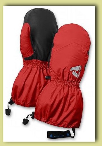
Gear Review - Eddie Bauer First Ascent Summit Mitts

Eddie Bauer states that their First Ascent Summit Mitt is "a choice for high-altitude climbers venturing into inhospitable places, this mitt ensures that your digits stay toasty warm even in severe weather." I was about to put that to the test.

Living in Alberta, I have come to the foregone conclusion that cold is just a part of life - especially if I want to enjoy the mountains. You can either learn to enjoy it or hibernate for 6 months of the year. You see, Calgary sits at 51N meaning that come winter, the Polar Jet stream often sits to the south, bringing with it arctic air masses and freezing temperatures that can plummet into the -30s. In the mountains these freezing temperatures can be compounded by extreme winds and elevation that can drop temperatures down to the -50s, causing frostbite and hypothermia in minutes.

For several seasons I was grappling with keeping my digits warm during those winter excursions. I had tried many brands and types of hand protection. I had always been a person that preferred gloves to mitts. To me, the tradeoff of dexterity to warmth was enough to keep my fingers isolated. I managed well with polypropylene liners and thinsulate gloves for most of the time. The gloves allowed my fingers to move independently and grasp things and when they got cold, I would pull them into the palm of the glove, move them around and warm them back up. It was a minor inconvenience but one I was willing to pay. I have to admit though, in temperatures of warmer than -20C, the glove/liner combo did well. But what about the times when as you ascended the temperatures continued to fall?

When temperatures dipped below -20C, I turned to a hiking favourite - oxygen activated carbon hand warmers. These don't add a lot of heat, and having them in the palm of your hand really can be very uncomfortable. So I went out and bought a pair of gloves that have a pocket for hand warmers that fit over the back of your hand. Was this to be my saving glove? I decided to put it to the test. In late November a group of friends and outdoor enthusiasts decided to hike to the summit of Paget Peak - as we pulled into the trailhead parking lot just outside Trail BC, the thermometer on my car read -36C and the summit was still 900m above where we were standing, and it was barren - meaning no trees to act as a windstop. As we gained elevation and broke free of the trees the temperature started its decline fairly quickly, finally coming to a rest at -43C on the summit. The sheer cold of the day was only offset buy the spectacular brillance of a clear windless summit, but the gloves with their liners and handwarmers were not doing the job. I found my hands clenched inside the palm of the gloves almost the entire trip. I had even somehow developed a technique of holding my ice axe with my hands clenched. Totally not safe but it gave my finger some warmth. What I took away from that trip (minus moderate frostbite on my nose) was that gloves just didn't cut the cold and that I was going to buy a pair of gloves, not just any gloves...a good warm pair of gloves, ones that did the job.

Thus my quest for a mitt had begun. Having worked in an Outdoor Camping & Hiking store previously, I knew what I had in mind and what companies had what out there. I had also read reviews from the net, talked to people about their experience with mitts and even tested out several makes and styles. I had my eye on the Black Diamond Mercury Mitt when I cam across the First Ascent Summit Mitts while shopping for some base layers at my local Eddie Bauer (they're base layers are also top notch). The first thing that stood out was the colour. One thing I have been moving more towards in my outdoor wardrobe is brighter colours, these can prove invaluable in times of distress. After the colour the next thing I looked at was the insulation - and this is where I fell in love. The Summit Mitt boasts a dual-layer primaloft shell with a removable 550-fill goose down liner, both lined with a wool-poly blend. Talk about the best of both worlds. Primaloft has one of the highest warmth-to-weight ratios of any current synthetic insulation, it also retains more of its thermal capabilities when wet - which is why I think Eddie Bauer/First Ascent hit a home run using it on the outside and having the down in the liner. The Summit Mitts also contain a durable leather palm for extra grip and abrasion resistance. So after waiting for the Eddie Bauer Anniversary sale, I purchased the mitts and promptly put them to the test. The mitts sell for $149 CAD.

It was the middle of the week when I received them from Eddie Bauer (free Fed0Ex Shipping) so I had to try them in an urban setting first. The temperature was -32C with windchill and wearing them while walking to work was great. My hands never felt the cold, nor did they sweat like some reviewers have experienced. This past weekend I decided to try them on an alpine hike, it was much more mild but the temperature still came in at a chilly -26C. Standing alone on the summit of Prairie Mountainwith the wind blowing - my hands were warm. The only drawback I found was these mitts are huge and cumbersome to work in. Thankfully Eddie Bauer added wrist straps so when you pull the liners out of the shell, you are stil wearing a 550-fill down glove and the shell cannot blow away. The fact that you can remove the inner lining and separate the gloves is an added benefit - and as the liner gloves are less bulky, but still wind-resistent, warm and they give you more dexterity to tinker with small things like zippers on backpack and nozzles on stoves. They even have leather added to the underside of them for added durability and grip. When its time to put the shell back on, the liner just slips easily inside and velcroes securely into place.

Eddie Bauer/First Ascent definately in my opinion hit a home run with the First Ascent Summit Mitts, though I guess though with names like Ed Viesturs, Dave Hahn and Peter Whittaker behind the brand it ought to be good.

SUMMARY

PROS

  • Built-in flexibility
  • Lightweight and warm
  • Packability (can be "squished" easily)
  • Windproof/waterproof
  • Wrist straps to keep shell/glove on body
  • Stylish colour
  • EB Lifetime Warranty
  • Free shipping when ordered online

CONS

  • Some may find it bulky when together (but considering what they are designed for, its accptable)
  • Cost (may be priced outside of some peoples comfort zone - but is great for what you get)

OVERALL RANKING: 5 / 5

Saturday, March 5, 2011

2011 Mountain Season Begins - Prairie Mountain

Each year, the combination of short cold winter days, snow and increasing avalanche conditions drive outdoor mountain enthusiasts to smaller and less complex mountains. Many people simply stop climbing and scramblign mountains, instead opting to climb aboard a chairlift that guides them to the summit where they then strap two waxed 2x4's of wood and slide down the slopes. For those, however; that continue to walk and climb up the mountains, the longer days in March are a warm welcome in the midst of cold temperatures

With the coming of March in the Canadian Rockies, the physical and mental preparation for spring, summer and fall scrambles and climbs to taller and more complex peaks begin. It is this time of year that I like to perform increasingly longer hikes and scrambles to increasingly higher elevations (as long as conditions permit). These usually take me to the familiar mountains and peaks of Canmore, Lower Kananaskis and Bragg Creek areas.

Today Prairie Mountain became my first conditioning hike for the upcoming 2011 scrambling and mountaineering season. The forecast was to be partly sunny with a high of -17C, it however ended up being overcast and a high of -26C (thanks to my new Eddie Bauer First Ascent Summit Mitts (review to come shortly) my hands never felt the cold one bit). This hike was also the first of my trips where I will be pushing my pace and endurance as I prepare for my Mt. Meru - Mt. Kilimanjaro expedition scehduled for February 2012.

Prairie Mountain is an innocuous mound of forested rock located across the road from Elbow Falls about 20 minutes past Bragg Creek Alberta with a summit elevation of 2210m (7252ft). Its not an exactly an exciting or visually appealing route - which is one of the reasons I had avoided doing it previously. What it is though, is a sustained climb of 716m (mostly through trees) over a distance of 3.8km (an average slope of approximately 21%, with a maximum slope of almost 51%). The ascent provides little in the way of scenery as there are only a few places where you are close enough to the edge of the forest to overlook the prairie expanse below. After starting out realtiveView From Summit - Click To Enlargely steep from the roadside, the trail flattens for a distance, this is a nice reprieve considering the trail unbeknownst to first-timers, is about to get steeper. In winter I would recommended micro-spikes or crampons as many people were using the trail to descend down on their bottoms - compacting and smoothing the snow making the steep sections quite slippery for those ascending (I had crampons, just opted not to take the time to put them on). As the trail winds its way through the forest, you can lose sight of the summit, but by looking pwqrds you can see the tree crowns stopping, this gives hope that the summit is near. After the final cluster of switchbacks the trail emerges from the trees to an open alpine prairie and a wide gentle approach to the summit begins. This final approach takes about 10-15 minutes in winter.


The summit approach provides fabulous vies of Canyon Creek Valley to the north, Moose mountain however is hidden until you reach the actual summit. The summit cairn consists of a giant pile of rocks with a 10ft branch sticking out the middle. From the summit you get a sweeping view of the surrounding mountains and if you look at the sumit of Moose Mountain, you can see the old fire tower on the summit.

I have had a few people ask the scale of mountains, so I have added a profile of the Prairie Mountain hike and added in a scaled CN Tower image to show the scale.


Thursday, January 6, 2011

Mt. Kosciuszko - The Highest Point In Australia

Boy, its taken a long time to write this. Between training for the South Dakota Kayak Challenge and planning/researching a Mt. Kilimanjaro/Mt. Meru expedition I really haven't had much time to do this.

Its sad since Kosciuszko does hold he title of tallest Mountain in Australia, its also part of the Bass List of Seven Summits (the highest mountains on each continent). At 2228m (7,310ft) it is the smallest mountain on the list - which also includes: Mt. Everest (Asia), Mt. Aconcagua (South America), Denali (North America), Mt. Kilimanjaro (Africa), Elbrus (Europe) and lastly Vinson Massif (Antarctica).

Its argued that Kosciuszko (Kosi as the locals call it, Tar Gan Gil to the Aborigines) does not belong on that list and that Carstensz Pyramid in Indonesia is the tallest mountain on the Australia/Oceania continent, standing at 4,884m (16,023ft). This debate has led to two Seven Summit lists, the Bass List and the Messner List. The only difference between them is the Kosi - Carstensz switch. But alas, this is not about that debate or winning anybody over, its about the beauty and experience I had journeying to the roof of Australia and my first Southern Hemisphere summit.

My goal at the end of 2010 was to have climbed/scrambled/hiked/etc to the summit of 30 different mountains, as winter came I knew I would be hard pressed to make it. On December 29th - over 14,000km from home, Mt. Kosciuszko became number 30.

During the afternoon of December 28th, my wife Deb and brother-in-law George packed our car with camping gear and headed out to Jindabyne NSW, we arrived at our campsite just after midnight on the 29th, and decided to promptly go to bed. The next day we got up and decided for the ease of first-time hikers that we would ascend via Charlotte's Pass, a modest total elevation gain of about 400m, but a horizontal distance of about 17km round trip. We started out on the trail at about noon. Before long the parking lot was well behind us and we were hiking our way through the Great Dividing Range. The first thing that I noticed was still patches of snow - this was afterall in December, the middle of the southern hemisphere's summer. Even at an elevation of about 2000m (7000ft), I had expected the snow to have sublimated away at the very least under the power of the Australian sun. Not that I was complaining, I am actually happy there was snow. The next thing I immediately noticed, was the lack of large dominating craggy spires and peaks. It was a very nice change from the peaks of Alberta, it provided a very exotic feel, especially with the gum trees. I kept an eye in the valley for the chance to see a wallaby, kangaroo or emu, but alas, I believe the preceding cold weather had driven them to lower altitudes

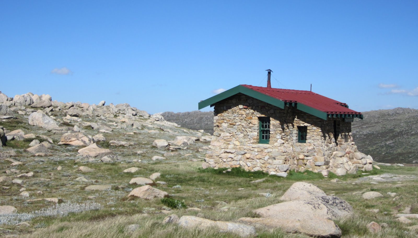
Another bonus of this route (which is the most popular) was the fact that after about 4.5 kilometres, we had the pleasure of passing another Australian Icon - the Snowy River. This is the same river made famous by Banjo Patterson back in 1890 and then renewed its fame with a 1982 movie starring Kirk Douglas. The Snowy River has its origin a mere 4km from the the trail and is fed by melt water from the snows. After watching the tiny fish swim around, posing for a few photo ops and dipping my foot into the waters, we continued on our way to Seaman's Hut (a winter refuge for back country enthusiasts) at 2030m. The hut is also a stark reminder that even a relatively small innocuous mountain can turn deadly. In 1928, W. Laurie Seaman and Evan Hayes died in a winter storm while. The Seaman family built the shelter for future park users to prevent another such tragedy. Sadly over the years, people have still fallen victim to avalanches and winter storms.

When we all reached Seaman's Hut, we knew we were within 4 km of the summit. I must admit I was getting excited and just couldn't get bored of the scenery. The trail made a long twist around a rocky outcrop and more of the Australian Alps that were hiding became visible. A high peak came into view, with its rocky top, I pegged it (correctly I later found out) to be Mt. Townsend, the second highest peak in Australia (a mere 19m shorter than its sister). From previous research I knew this to be only 3.8km from the summit of Kosciuszko. Along the walk I put out a feeler to Deb and George if any of them wanted to do a quick side-trip to Mt. Townsend and bag the second highest moutain in Australia. That suggestion was met with a duel no. I mentioned the traverse would be short, and elevation loss minimal. Again, double no. I even tried the patriotic card, telling them that they could be one of the few to stand on the two highest peaks in their country. That seemed to have little effect, so I gave up. But not before I put it in my mind (and mentioned it in passing) that next time we come to Australia, I will be spending a few days camping and bagging some of the other mountains in the area. Shortly after a party descending passed us and we asked where the summit of Kosi was. They told us that in a few minutes the trail would bank a hard left and we would see it right in front of us. In fact the mountain we were looking at straight-on was the south-eastern slope of our intended destination - the summit was just blocked by the hill beside us. Sure enough, within a few minutes, the summit came into view - I can't say it was awe-inspiring or a take-your-breath away moment but it wasn't disappointing either. It was little more than a rounded knob with a few patches of snow, but breathtaking in its own right. What none of us really realised at that time, was that Kosciuszko was holding a present for us, only to be shown to those that summit.

Before we made the final summit approach, the trail leads you to Rawson Pass (2100m), home of Australia's highest toilets built in 2007. Cleaned daily they see approximately 100,000 "visitors" a year. Just a nice bit of trivia really.

From Rawson's Pass the trail climbed the final 122m along the south-eastern face of Kosciuszko before starting a one-loop spiral that would circumnavigate the entire summit before ending at the Survey Cairn that marked the highest point in Australia. In my opinion this is where the scenery changed from great to excellent (as with the vast majority of summits). Now higher than most of the surrounding peaks, the scale of the Great Dividing Range became apparent, until this point, we were hiking through a valley, slowly gaining elevation, our views limited by the mountains on either side of us. Now, free of the valle confines we were able to peer into the far distances. We were able to see the various walls of mountains undulating into the horizon, stopping only where they ran against the clouds of the sky.

Before long, were came around the final corner and the summit cairn was in view. After about 4 hours and 8.5km of hiking we had reached the Roof of Australia. After taking our obligatory photos with the summit cairn, we sat down and enjoyed the great weather, scenery and natural beauty of the area before heading back to Charlotte's Pass.


Sunday, November 14, 2010

Mt. Lipsett - Exploring Opportunities In Highwood Pass

After two weeks without being in the mountains, I was anxious to get back into them. This is however mid-November and conditions can change quite a bit in that time, as such I decided to choose a mountain that is relatively easy and quick, this would also serve two other purposes (aside from becoming summit 27). I used this opportunity to check out the mountain conditions along the Highway 40 corridor as well as scout some new prospects for next summer.

The day started with a 3:55AM wake-up to meet-up with the rest of the crew. I met up with Siva at 4:45AM and we headed off to the University to meet up with another. Unfortunately he was unable to make it, in fact, neither of the other 5 were able to make it, leaving just Siva and I to do this mountain. If I had thought to check my e-mail before heading out, we would have known just after 5:00AM that we were to be flying solo and likely could have started at 7:15AM instead of 8:10AM - LESSON LEARNED! The good thing is that we were provided a great vivid alpine sunrise.

The hike itself was very uneventful and not the most inspiring. The trail was quite circuitous wrapping around and back over itself through a pine forest slowly approaching the treeline. We pretty much knew the 'fun' was to begin once out of the trees, and again we were not let down. As we approached the false summit, the wind started whipping around - we estimate that it was around 40kph - not enough to physically move us, but enough to turn the snow crystals into eye hurting projectiles. Sive noticed a small herd of Mountain Sheep hunkering down behind some trees below us. As we crested the false summit we noticed a higher summit further off, we decided to grab a quick shot at he false summit before moving to the true summit.

As we began our approach to the true summit, the wind decided to throw up even more force. This time we were actually pushed by the wind and could hardly hear each other talking (even at close distances). We forced ourselves along the rock spine to the summit where the sun decided to greet us and the wind died down slightly. So without the wind and subsequent high-windchill, the trip was pretty straightforward.

The total elevation gain was 706m, distance was approximately 14km and total trip time was 5 hours.


Sunday, October 31, 2010

Rimwall Summit - 2010/11 Winter Scrambling Is Officially Here!

Rimwall Summit is a moderately rated scramble that has an elevation gain of 1020m/3,346ft and a summit elevation od 2680m/8,792ft. It has been on my to-do list for a while and with summer quickly slipping away and winter taking its chilly frozen hold on the Rockies, there was no better time than now to do it.

With three friends, we left Calgary at 5:00am with dreams of a clear pre-sunrise approach followed by an alpine sunrise giving way to clear blue skies and a high of 3C, afterall, this is pretty much what the forecast told us - we should have also realised that the closer you get to the mountains, the less you can trust the forecast. We knew it would be chilly when we first arrived at the trail head, and chilly it was (cold is in a different class than chilly - as you will shortly find out). The lack of clouds caused the mercury to drop a bit more and as we exited our warm cozy vehicle, we were welcomed with an brisk ambient air temperature of about -9C. Let this be a lesson, never keep a car very warm when you are to go winter scrambling or hiking, slowly lower the internal temperature so its not such a shock to the system when you get out (we knew better).

We started our approach under a half-moon with the constellations shining brightly above us - Orion and Cassiopeia being the main stellar attractions. The first part of the approach was through forest on a nice trail, but having to keep with tradition, Siva and I decided that off-trailing would be (as we normally do) the way to go, so off trail we went scrambling some rockbands and doing some minor bushwacking until we finally came to the treeline. From the treeline we knew we had to continue up, but this is where things started getting interesting. We were provided a nice sunrise off of Mt. Lougheed as its snow dusted and cloud enshrouded summit burned red under the rising sun, but the clouds wouldn't stop rolling in, and soon enough visibility was reduced to about 10m in any direction. The wind was blowing at what we estimated was 60-70kph, snow crystals became eye-stinging ballistics, and the temperature quickly plummeted to below -20C, even our insulated drinking tubes couldn't withstand the coldness and succumbed to freezing solid.

Without this temperature and conditions, I don't know how eventful the summit trip would be, but add blustery winds, low temperatures and a bit of snow and ice and you get some good stories to tell - like how we only really knew the general direction to go and where the general location of the big cliff was. Suffice it to say we continued on to the summit, scrambled over the snowy, icy cliff bands shoved a big stick in the summit cairn where we took a few pictures and then headed down after a poor attempt to find the summit register. The funiest thing happened about 35 minutes of leaving the summit. The wind stopped, the angels sang and the clouds parted to reveal a beautiful clear autumn day overlooking Spray Lake the the entire length of the valley.

We did see another group of 6 people heading for the summit as we descended and knew they would now have a great trail to follow and have a great clear summit experience. Our experience was great though, the addition of bad conditions makes the ascent more interesting and adds a new degree of difficulty, at the very least, we didn't have to peer down on Canmore one more time from the summit and the windburn on our face will subside. 5 hours and 55 minutes after leaving the car, we were again standing on the side of the road putting our gear in the trunk and getting ready to go to Canmore for some hot chocolate.

On a sad note, as I did check "Rimwall Summit" from my list, I had to add "new camera" to it, as it succumbed finally to the orgy of rocks, cold, snow, trees, bumps, scrapes, drops and wet that the mountains had thrown at it over the past 2 years. Here is the last video that my camera would take (listen to the wind).


Thursday, September 16, 2010

More Adventures At Moraine Lake - Tower Of Babel

The past weekends mix of low temperatures, low-lying heavy fog and wet snow kept most people indoors and those that went outdoors mainly stayed low. It also provided the opportunity for some quiet scrambling with some friends without the hoardes of people and late year tourists as well as some spectacular photos. It also allowed me to bag my 7th peak of the year.

We left Calgary just after 5:00am en route to Lake Louise in Banff National Park. I've had my eye on a small 455m quartzite spire named The Tower of Babel for some time. I had to cancel my two previous attempts due to heavy rains in the area, but decided unless there was lots of snow on the ground, we would attempt a summit. When we arrived at the parking lot it was a balmy 3C with a low cloud cover. We geared up with all the mandatory scrambling gear necessary for a slippery scramble up a very enclosed gully.

The total round trip time for ascent and descent was a mere 4 hours and provided us an opportunity to relax at the summit and take in some of the views that the low clouds and fog were providing. The ascent was through a narrow gully, although there is some optional moderate scrambling on an outcrop that forms the right wall of the gully. We decided to venture up a few times, but found that when slippery the loose rock can be trecherous and rockfall abounds, so a helmet is not an option but a necessity.

For a small peak surrounded by giants, the Tower of Babel can offer supurb scenery, the light dusting of snow slightly higher up mixing with the fog and the changing of the larch trees was a fantastic bonus that none of us expected. Well worth the trip and we'll likely be heading back next year for a summit camp. Enjoy some of the pictures below of our trip.


Wednesday, September 8, 2010

Back From Hiatus

Its been exactly two months since Tyler and I placed our boat into Spring Lake in San Marcos Texas and armed with 8 lbs of food each, 4 paddles and one boat, started our 262-mile, 76 hour endeavour to finish the Texas Water Safari. In the next couple of days I will be posting about the race, my experiences, feelings and lessons learned. I'll be posting statistics of our run and valuable lessons learned as well as possible future ambitions.

In the time between the Texas Water Safari and now, I haven't been nearly as active on the water or in the mountains. I've been taking time to spend with friends and my wife, who all had to put up with a lot during my training. From picking me up in Drumheller at 4:00am on a Sunday to sacrificing entire weekends without me to watching the travel costs increase tremendously.

So stay tuned...

Wednesday, June 30, 2010

TWS v.2.2010

As most of you know by now, Tyler and I will be back in Texas on the 8th of July to race in the 48th annual Texas Water Safari.

Like before you will be able to follow us live by clicking the TEXAS WATER SAFARI 2010 link on the right hand side of the screen and following the instructions.

Thursday, June 3, 2010

The South Dakota Kayak Challenge - 75 Miles Of Wind, Water & Waves

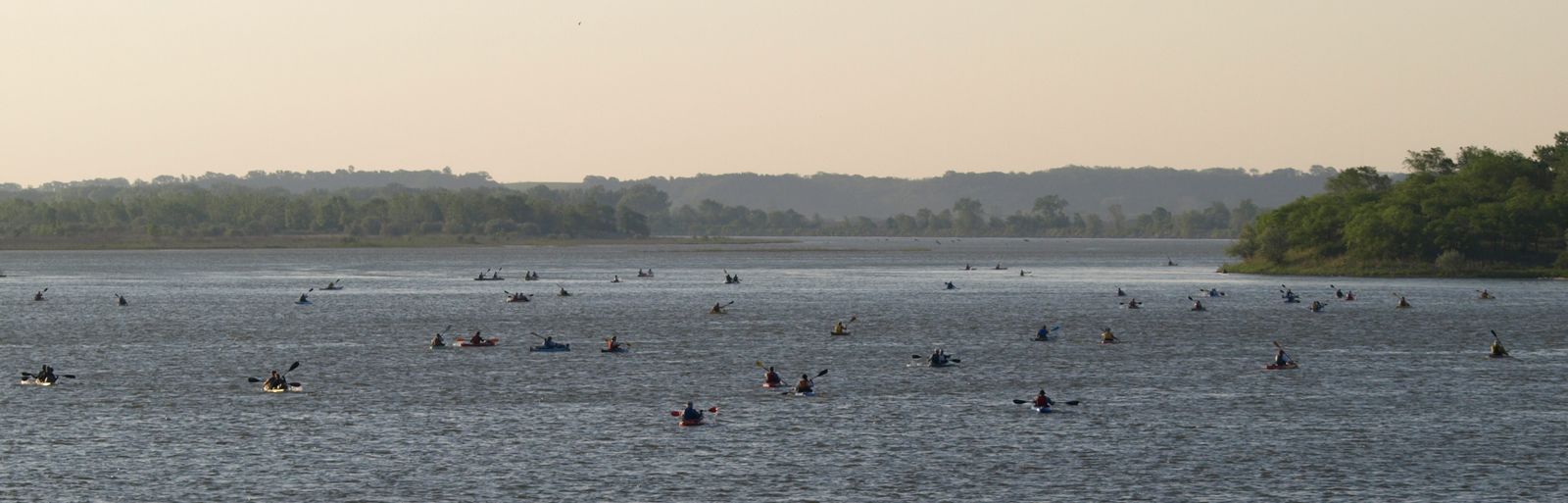
On May 29th over 100 paddlers descended upon Yankton , a small city in southern South Dakota, bringing with them 77 canoes and kayaks of various size and style. The people were there for the inaugural South Dakota Kayak Challenge, a 75 mile race along the Missouri River ending in Sioux City Iowa. The race brought competitors from around the American Mid-west, representing 9 states and us, a lone boat from Canada.

Our SDKC journey began with a 2000km (1250mi) drive. We left Calgary the evening of June 27th in the midst of a rain/snow combo. The trip took us across Alberta and east into Saskatchewan where we crossed into North Dakota at the North Portal Saskatchewan border crossing as the first daylight came over the horizon. We continued east to Fargo ND which is just west of the Minnesota state border, then turned down I-29 and arrived in Yankton SD a mere 23.5 hours after leaving Calgary. In fact, we were a little late and missed part of the mandatory safety meeting. When we arrived, we were greeted with 22C weather and sun, a far cry from the near winter conditions we left Calgary in. As we exited the car, we took note of the boats that were already at the campsite. Most notably we took an inventory of the canoes there (since that is what we were in), a couple of Wenonahs (Jensen, Minnesota II) and a few carbon fibre 20" boats. Lined up among the canoes were many kayaks (massinvely outnumbering the canoes). Current Designs, Surfskis and Pelicans among many others. After catching the last of the safety meeting, we checked in, received our shirts and pulled our 16' Clipper Prospector (racing and prospector - two words the do not go together, but our racing boat is in Texas being fitted for the Safari in two weeks time) off the car and prepared our tents for an early night, afterall the race started at 7:00am sharp.

By 5:45am on race day, a vast majority of people were up. Riverside park in Yankton was abuzz with people having breakfast, taking down their camps and moving boats to the starting beach. By ten to seven, almost all the boats were lined up on the shore and the competitors made the last minute preparations to their boats and awaited the US Military to fire the starting gun (after all it was the Memorial Day weekend). At 7:00am sharp two soldiers fired their rifles to signal the start of the first ever South Dakota Kayak Challenge. Within seconds the Missouri river was alive with activity as boats slipped into the river and began the journey to Iowa, passing through 4 checkpoints along the way. In all seriousness, only a few boats had a chance to win the race, and these boats separated themselves fairly quickly from the pack. By mile 10 about 15 boats had separated themselves from the entire pack.

The first 30km (19mi) seemed to fly by as we were surrounded by boats, specifically three other boats that we seemed to pass, just to have them pass us and we would then pass them again, this went on for the vast majority of the race. Ti first thing we noticed was that the Missouri River (unlike the Red Deer and Bow in Alberta) was deep enough in most places to get a full stroke into the water, something that we've sadly been missing in our practices. This made the ease of paddling easier and the stroke much more efficient as we could get the vertical motion needed to drive the canoe forward. T he only time this didn't occur for any distance was a small 1km stretch just before checkpoint 2 where we opted to go around a lrage sandbar to the east. Two kayaks went to the west and passed us. By the time we reached checkpoint #2, the fastest boats really pulled away and we could barely see them on the horizon and four boats made up the "chase group", comprised of 2 kayaks, one 20' carbon fibre/kevlar canoe and our little prospector chugging away at an average speed of 11.6kph (7.2mph) we had our GPS rigged. Unfortunately that would not last long, by mid-day the wind had started to pick up and soon we found ourselves paddling into 20-30mph headwinds, virtually negating the current. In fact some paddlers told me when they stopped, the wind would actually blow them upstream against the current. It was this wind that caused most the problems. By 2:00 about 6 boats had already dropped out, by 5:00 I was told that number had increased to the double digits, by the end of the race, 23 boats would succumb to the wind and distance.

Over the last 32km (20 mi), the wind really played havoc with our speed. Our shourt, wide flat bottomed boat with no skirt scooped the wind and pushed us back. Coupled with the biggest challenge of the race - drunker recreational boaters purposely causing wakes - some over 3' tall) our speed fell to an average of 7.8kph (4.5 mph) for a total race average of 9.2 kph (5.7mph). After pulling into Bev's at 6:51pm we were both feeling pretty good - especially after we were told we were 7th overall and first in our division. We took a quick swim in the water - jumping off the pier (once on purpose, the other by accident) then went and sat down for dinner with some fellow racers, such as Bryan who won overall in just over 10 hours. Bryan talked to us of the Missouri 340 and really stolked our interested, perhaps next year, but definately we'll be in a much better boat, perhaps a Jensen or something similar. This year we have to focus on the Water Safari in Texas in a few weeks therefore a trip to Kansas City is sadly not in the budget.

Unfortunately we couldn't stay for the awards ceremony the next day. We rigged our canoe for the 1600 km (1000 mi) drive back to Calgary (we were to go through Wyoming and Montana this time). At 10:30pm or so we started our trip back to Canada, having said bye to event organizers Jarett and Stephen and several other racers that we met along the way. We decided this is definately an event that we will likely be back to again, it was organized great and the hospitality was quite amazing. Kudos to all that helped organize such an event and have it run so smoothly. I am sure everybody, regardless of how they finished, enjoyed themselves and the event. On Monday morning just before leaving South Dakota, we pulled over at a rest stop and had a quick awards ceremony of our own, more of a keepsake picture more than anything.

We arrived back in Calgary at just after 1:30am Monday May 31st, tired but excited that we had just accomplished a race after 24 hours of driving and very little sleep each. It truly is amazing how far your body can be pushed if you are determined to finish something. As a side note, it was joked that we currently hold the Canadian Record for the SDKC, albeit not a good one and only because we are the only Canadian boat to take part, but hey, why not live it up while we can right?
Hope to see you again next year SDKC. Keep me informed Jarett and Stephen.
Next up, 262 miles of the Texas Water Safari - June 12, 2010

Tuesday, May 18, 2010

Texas Water Safari -The First 100km

Have you ever wondered what the Texas Water Safari was like? The next few installments of the blog will breakdown the race, providing you an opportunity ro understand the race better and what the participants go through.

On Saturday June 12th at 8:50am, over 100 boats will put into the water at Aquarena Springs in San Marcos Texas and pull into their starting positions. For the next 10 minutes, the armada of canoes and kayaks will gently bob in Spring Lake. The temperature will already be in the mid 20C (75F) range and the humidity will be rolling in.

At 9:00am, a single gunshot will send over 250 paddlers thrashing across the lake, crashing into each other and jostling for position en route to Joe's Crab Shack Dam a mere 400m (1/4 mi) away. Once the boats have traversed the little lake, the paddlers will jump out into the mud and water and start a downhill running portage through dense bush, roots, sharp rocks and other racers. Hazardous rocks threaten to twist ankles, tear flesh and damage boats en route to the mouth of the San Marcos River, a river that will take them to the Guadalupe River, out into the Gulf of Mexico and onto Seadrift 421km (262 mi) away, and that is just the first kilometre of the race.

Over the next 3.5km (2.2mi) there are two more dams and 3 portages (2 mandatory). The Rio Vista Dam, a mere 1.2km (0.75 mi) from the race's beginning provides a opportunity to run the small spillway if you don't feel like portaging, however, many boats that attempt are thwarted in their effort and end up capsized with their paddlers scrambling to catch their boat and gear as it floats down the river and then upright it so the can continue as the spillway descends into a 4ft (1.3m) standing wave

In fact, this section of the river is often considered the most difficult part of the race. Aside from the 7 portages, 4 low clearance bridges and 2 rapids, this section contains what is locally known as the "Gnarly 40". Forty miles (64km) of tight, tree clogged and log jammed river channel between Staples Dam and Palmetto State Park. In years of high water, log jams can be nearly a mile long, being unable to paddle them the racers have to traverse across the log jam with their canoe and gear, being careful not to breakthrough or have their boats swept underneath. These "logjam portages" often take more than one trip eating up valuable time. These trees are also prime habitat for black widows and cottonmouth snakes, both highly venomous.

This section also contains the Cottonseed Rapids, a long stretch of rocks and white water with a narrow chute exit which is a favourite spot for many spectators. Many boats that attempt to run this section are swept into rocks, paddlers are tossed from boats, canoes and kayaks capsize and fill with water and gear is swept downstream, if lucky the boats sustain no damage and the paddlers can meet up with their boats and gather their gear further down. Those that are not lucky can find their boats pinned or even rupture their hulls which can either end their race a mere 16km into the race or spend critical time repairing the damage which can be moderate or severe taking up to an hour to repair. Boats pinned to rocks by the force of the water often find themselves in the way of boats shooting the rapids and can cause significant collisions.

If that wasn't enough, the portage at the Ottine Dam is considered one of the hardest by many racers in this race. Due to the strong current of the dam, you must pull over well above it or face the chance of being swept over, you then must pull the boat out of the water and up a steep slick river bank and down a slippery clay slope covered in dense trees, prime location for poison ivy, fire ants, and venomous snakes and spiders, a bite from either can prove fatal to a human in an exhausted and stressed state. Not to mention prime real estate to drop a canoe or injure oneself.

To top it off, racers have to finish this section by 10AM Sunday, a mere 25 hours after the race starts.

This is the first 100km of the Texas Water Safari, "The World's Toughest Boat Race". Stay tuned for the second 100km.

Monday, May 17, 2010

100 Kilometres Of The Beautiful And Weir-d Bow River

This was a big weekend for Team Chinook, it marked the two week countdown to the inagural South Dakota Kayak Challenge and four weeks to the Texas Water Safari. It was also the second 100km (61 mile) trial run for Team Chinook and the first in temperatures exceeding 20C. It was also our first practice run where anybody with internet access could track our progress virtually live through our SPOT unit, as we paddled the world famous Bow River from Bowness Park in Calgary to Carseland Alberta.

Being mid-May, the water level in the Bow is still relatively low, as such the flow volume is low and the speed is slower than normal. This section of the Bow offers relatively little in the realm of dangers for paddlers and is very straigh forward, there are a few class 1+ rapids and numerous ripples. The only real dangers are the two weirs that are along the way, on in downtown Clagary and one just to the east as you enter Carseland. Each providing a mandatory portage due to their trecherous hydraulics. I've heard and read before that the weir in Calgary is responsible for a number of deaths, one of them not to long ago. As you approach both weirs, signs warn you of the danger ahead and a string of bouys delineates the safe zone from the danger zone.

The weirs were created for aeration and diversion of water to irrigation channels and produce an amazing hydaulic cycle that if you get caught it, it would be impossible to get out of. It also provides a habitat for pelicans as they wait in the wake of the water looking for fish that get swept over. Due to the construction of Harvie Passage in Calgary and the removal of the Weir, we ended up having an 800m portage, although I must admit that it was an easy one, along the Bow River Bike Path. We did run into an older gentleman who was familiar with the Texas Water Safari through readings and wished us luck.

Below the construction, the water level dropped dramatically not even allowing us to get the entire blade of the paddle into the water, after a few hundred metres the water deepened, then would shallow out again. This pretty much was the course for the rest of the urban paddle. As we approached south Calgary we finally found life in the river, people were out at the dog park and the fly fishers were out in full force. We managed to see some impressive trout being reeled in, one was easily in the range of 24 inches, which to me is a big fish.

Over the next 30km (18 miles) we passed easily two dozen fishing boats and easily twice as many fly fishermen/women than we did boats. It was our first time having to share the river with watercraft or person this year, and from our numerous and brief conversations, it was many of these people's first times out as well. Its amazing what happens once the temp hits the mid teens.

After running a few class 1+ we were greeted by a big white warning sign telling us to stay to the left channel to avoid the weir in Carseland and prepare for a mandatory portage. At this point our average speed fell from 10kph even to about 3 as we had to exit the boat numerous times to ferry it through shallows, rock gardens and wet gravel bars. Thankfully after 40 minutes we were at the portage and the end of our route. Total time was 9 hours and 32 minutes and total distance was 101km (61 miles) for an average moving speed of 9.9kph (6.1 mph), providing a food warm up to next weekends timed 360km (225 mi) practice run.